



Tachikawa was in Kanagawa from 1871 to 1893; its name and station were born there. Why did Tama move to Tokyo? Water, a felled forest, two governors, a split vote.
Tachikawa used to be in Kanagawa Prefecture.
I am not joking. From December 1871 (Meiji 4) to March 1893 (Meiji 26), Tachikawa (立川) belonged to Kitatama District of Kanagawa Prefecture. That is twenty-three calendar years by the old way of counting, or about twenty-one years and four months in real time. During those years, this land began calling itself “Tachikawa village” and welcomed Tachikawa Station on the Kobu Railway. In other words, both the name of the village and the station itself were born in Kanagawa.
I have walked around the front of Tachikawa Station many times, and when I learned this, I felt as though the ground under my feet had slid a little sideways. This western hub of Tokyo, with the monorail gliding overhead and the pedestrian decks overflowing with people, was once a village on the northern edge of the prefecture that holds the port of Yokohama.
For readers new to the area: today Tachikawa sits in the Tama area, the western part of Tokyo Metropolis beyond the 23 central city wards. Kanagawa is the neighbouring prefecture to the south, home to Yokohama and Kawasaki. Today the boundary between them feels as permanent as a coastline. It is not.
So why was Tachikawa moved to Tokyo? Who proposed it, and why in 1893? And when it happened, were the people of Tachikawa pleased, or angry? The more I dug, the less there was a single answer. There was a story about water, a story about a forest, the private calculations of two governors, and at the end of it, two villages that make up today’s Tachikawa City, their names signed to two opposite documents.
Tachikawa was in Kanagawa: from when, until when, and how far
First, let me lay out the facts one by one.
Tachikawa Monogatari, the newsletter of the Tachikawa city-history project, sets out the changes of jurisdiction in a single table. According to it, in June 1868 (Keio 4), as power passed from the old shogunate to the new Meiji government, the villages of Tama that had been governed by the Nirayama magistrate Egawa Hidetake came under Nirayama Prefecture. Its prefectural office was in Nirayama, on the Izu Peninsula. Shibasaki village, roughly today’s Shibasaki-cho, and Sunagawa village to the north were both villages of a prefecture whose office sat in Izu.
After the abolition of the feudal domains in July 1871 (Meiji 4) and the merging of prefectures that followed, the Tama area came under Kanagawa Prefecture in December. In April 1873 (Meiji 6), Kanagawa divided its territory into 20 wards and 185 units: Shibasaki became “Kanagawa Prefecture, Ward 12, Unit 5,” and Sunagawa “Ward 12, Unit 3.” Under the large-and-small ward system of the following year, Shibasaki was grouped with Gochi village (today’s Akishima) and others as “Large Ward 12, Small Ward 4,” and Sunagawa with Kamiyaho Shinden (today’s Kokubunji) and others as “Large Ward 12, Small Ward 3.”
In November 1878 (Meiji 11), under the law on the organisation of districts, wards, towns and villages, Tama District was split into West, South and North, and Kitatama (North Tama) District was born. From then on, Shibasaki’s address became “Shibasaki village, Kitatama District, Kanagawa Prefecture.” If a Tachikawa resident today addressed a letter that way, the postal worker would probably look at it twice.
Then, on 1 April 1893 (Meiji 26), the three districts of Nishitama, Minamitama and Kitatama were transferred from Kanagawa Prefecture to Tokyo Prefecture. This is what is known as the “transfer of the Three Tama to Tokyo” (Santama no Tokyo iken).
Tachikawa was not the only one. Records of Kitatama District’s history show that Kichijoji village, Hon-shuku village in Fuchu, and the Shibasaki village in Chofu were all moved into Kanagawa one after another around 1872. Many of the towns along today’s Chuo Line, the ones now called “Tokyo’s west side,” were once Kanagawa residents together.
But some parts of Tama did stay with Tokyo. According to an exhibition report by the Tokyo Metropolitan Archives, Tama District, which was split in 1871 between Tokyo Prefecture and Iruma Prefecture, was later moved as a whole into Kanagawa. However, 32 villages in eastern Tama, corresponding to today’s Nakano and Suginami wards, were returned to Tokyo the following year, 1872, on the grounds that they were closely tied to Tokyo geographically and economically. Nakano and Suginami went home to Tokyo early. Tachikawa stayed in Kanagawa.
Why was Tama put into Kanagawa in the first place? The Archives’ report says Kanagawa Prefecture objected on grounds of managing the foreigners’ “walking zone,” and the whole of Tama District was transferred to it. To borrow an encyclopedia’s account, it was at the request of the Kanagawa governor, Mutsu Munemitsu, on the grounds that Tama fell within the zone in which foreigners living in Yokohama were allowed to travel.
A “walking zone” was the area around a treaty port within which resident foreigners were free to go about. So the people of Tachikawa had their prefecture decided by how far Yokohama’s foreigners were allowed to stroll. Prefectural borders, it turns out, are drawn for some surprising reasons.
Within that odd boundary, two things that shape today’s Tachikawa were born on this land: a name, and a station.
初日の汗は、予約した人だけが持ち帰れる。
The name “Tachikawa village” and Tachikawa Station were both born in Kanagawa
In March 1881 (Meiji 14), Shibasaki village changed its name to Tachikawa village. The name of today’s Tachikawa City begins here. Tachikawa village, Kitatama District, Kanagawa Prefecture. The first time “Tachikawa” appeared on a map as a village’s official name, it was in Kanagawa.
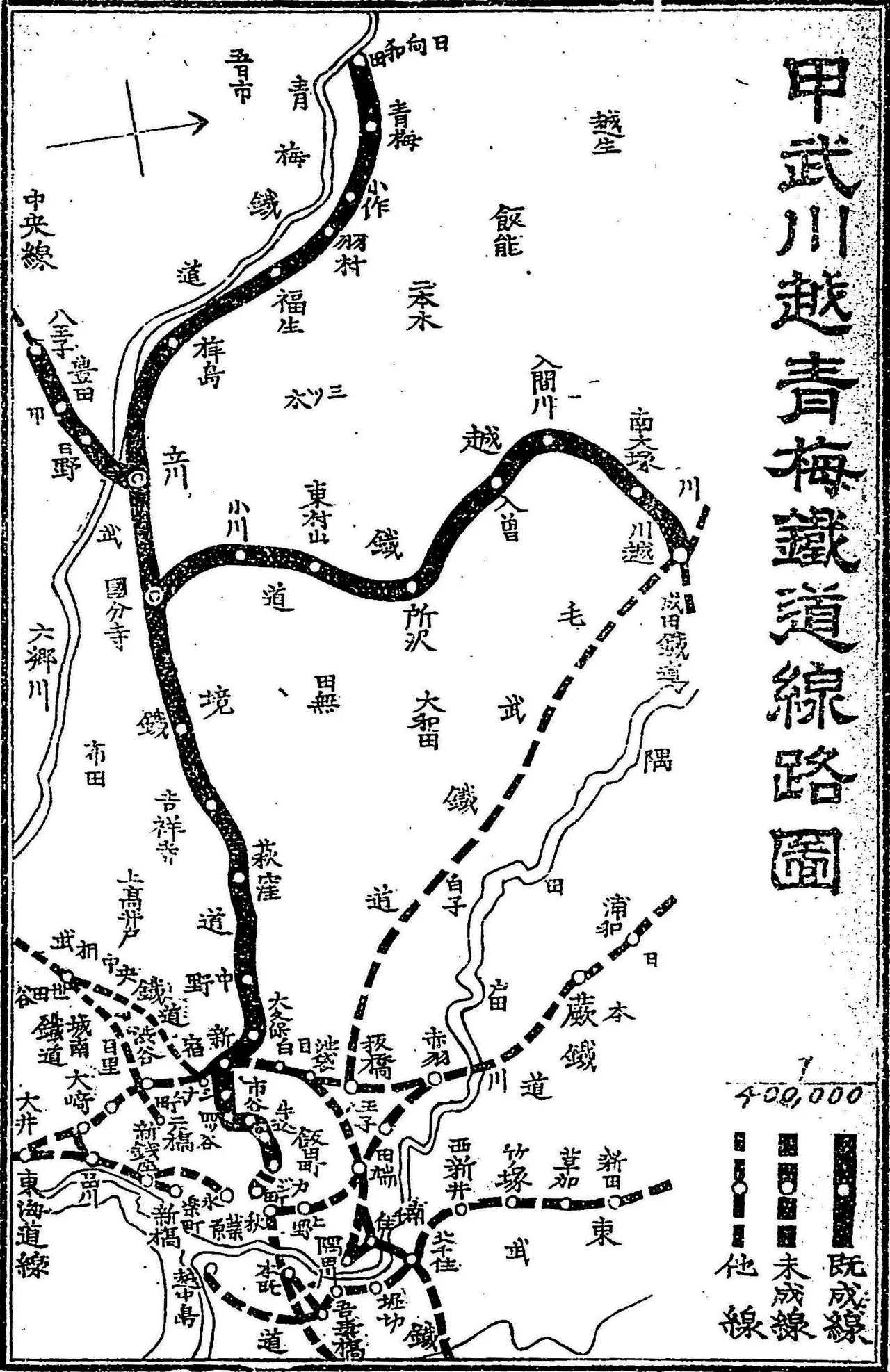
Photo: 木下立安 / Public domain / Wikimedia Commons
So why throw away the long-familiar name of “Shibasaki”? The city’s timeline gives no reason. But reading on through the city-history newsletter, I found a surprisingly businesslike reason mentioned in passing. I’ll make a little show of it and turn it into a quiz.
The traveller’s detour quiz
In 1881 (Meiji 14), Shibasaki village changed its name to “Tachikawa village.” Which reason does the city-history newsletter Tachikawa Monogatari give?
- A To honour the name of the medieval Tachikawa clan
- B Because there was another “Shibasaki village” in the same Kitatama District, and it was confusing
- C Because the name of the Kobu Railway station had already been decided
The answer is revealed on the last page.
After the renaming, under the revised law on ward, town and village assemblies of July 1884 (Meiji 17), Tachikawa village was placed in the “Nakagami Village and Nine Other Villages Union,” a union of ten villages headed by Nakagami village in today’s Akishima City. When the new municipal system took effect in 1889 (Meiji 22), Tachikawa left the union and stood on its own as a single village. At the same time, Sunagawa village absorbed enclaves of Tachikawa village and other land, and the boundary between the two villages was more or less fixed. Tachikawa village and Sunagawa village: these two would later become one Tachikawa City.
And on 11 April of that same year, 1889, the Kobu Railway opened between Shinjuku and Tachikawa. Tachikawa Station was born. In August the line reached Hachioji too. The table in Tachikawa Monogatari notes that the station opened on the north side of the tracks and that the South Exit was only added in 1930 (Showa 5). Today people stream through in both directions, but at first the station had an entrance only on the north side.
An old photograph in the first issue of Tachikawa Monogatari shows that the South Exit stayed small for quite a while into the Showa era. In 1961 (Showa 36), the station building was single-storey, and the caption says the station front seen from the South Exit was “very cramped.” In the 1970 (Showa 45) photograph of the Suzuran-dori shopping street (shotengai, a street of small local shops) outside the South Exit, there are still few tall buildings, and old-fashioned family-run shops line the street. On one corner stood a cinema called Tachikawa Toei, later the Toei Minamiza. The newsletter writes that at its peak Tachikawa had as many as ten cinemas, and that there was a time it was called “the movie town.”
On the North Exit side, the cover of the same issue shows the scene around 1965 (Showa 40). People and cars come and go along North Exit Avenue, amusement rides are visible on the roof of the Chubu Department Store, and across the street stood an Isetan at the time. Plenty of people must still remember those rooftop rides.
Back then, the South Exit was a narrow square in front of a single-storey station building, and at the North Exit, a department-store roof was the children’s playground. Now commercial buildings line Suzuran-dori, and a free passage and pedestrian decks span the station. The station that began in Meiji with only a north entrance grew a south one in Showa, and today it lets you step out into the heart of town whichever side you choose.
When it opened, the station’s village address was “Tachikawa village, Kitatama District, Kanagawa Prefecture.” Today’s gateway to Tama was born as a Kanagawa station. I want to tell this line to every Tachikawa person I meet.
The newsletter gives Tachikawa village’s population that year as 1,920. I will spare myself the embarrassment of comparing that with the number of people who use Tachikawa Station in a day today.
The Archives’ exhibition presents this very Kobu Railway as a factor that later pushed the transfer to Tokyo. One railway line can change the direction a village faces. That point will matter a little later. Before that, I want to check which way this land was facing in the first place. The answer lay in silk and water.
Silk flowed to Yokohama, water flowed to Tokyo
When Yokohama opened as a treaty port at the end of the Edo period, raw silk and other trade goods began to be carried from Tama to Yokohama. The Archives’ report says this deepened the ties between Tama and the Kanagawa side. In Sunagawa, north of Tachikawa, mulberry-seedling growing, silkworm raising and weaving thrived into the Meiji era. Thread and silk flowed south toward the port. From a merchant’s point of view, Tama belonging to Kanagawa was not so unnatural.
Water, however, flowed the other way.
Since the Edo period, Tokyo’s drinking water had depended on the Tamagawa and Kanda aqueducts. The Tamagawa Aqueduct (Tamagawa Josui) takes in water from the Tama River at Hamura and carries it in an open channel to the water station at Yotsuya Okido, once the western entrance to the city. According to the Archives, about 70 percent of that channel ran through Kanagawa Prefecture. The source of the capital’s taps lay in someone else’s prefecture. From Tokyo’s point of view, nothing could be more unsettling.
After the Meiji Restoration, management of the aqueduct passed from the Civil Engineering Office of the Ministry of Civil Affairs to the Civil Engineering Bureau of the Ministry of Finance, but it was not properly looked after, and problems arose one after another, the Archives’ report says. One was that boats travelled along the channel. Cargo boats, gliding over the drinking water. The report also mentions problems such as dirty water flowing in.
The people of Tachikawa were involved in this boat traffic. The timeline in Tachikawa Monogatari records that in 1870 (Meiji 3), a boat service operated on the Tamagawa Aqueduct, with Sunagawa village, Miyazawa Shinden and others taking part. The people of Sunagawa, in other words, ran a freight business on top of Edo’s drinking water. Rational enough, in its way. If there is a waterway, it is only human to want to float a boat on it. To the people of Tokyo downstream, boiling that water for tea, it was another matter entirely.
In November 1871 (Meiji 4), Tokyo Prefecture became involved in managing the aqueduct’s water distribution, and in 1872 the water-source facilities, including the intake weir at Hamura, were also transferred to Tokyo. Worried about water quality, Tokyo asked the government in 1872 to halt the boat traffic that had caused the deterioration, and the request was granted. The boat service ended after only about two years.
Tokyo’s worries did not end there. In 1873 (Meiji 6), Tokyo Prefecture first sounded out the government about moving the Tama lands along the aqueduct into its jurisdiction. It was refused. In 1874, it asked the Ministry of Education’s pharmaceutical testing office to carry out the first scientific analysis of the aqueduct water. In 1878 (Meiji 11), a flood on the Tama River prompted an investigation of the source, and Tokyo confirmed where its water came from.
Then in 1886 (Meiji 19), cholera broke out on a huge scale. To tighten control over the aqueduct, Tokyo Prefecture asked the government to transfer to it not just the land along the Tamagawa Aqueduct but Nishitama and Kitatama districts, including the upstream source. That, too, was refused.
Turned down twice, Tokyo still did not give up. But a third request needed some decisive trigger. It came in the winter of 1891, in the mountains of the upper Tama River.
1891: a felled forest, and a governor who had run the Bank of Japan
To protect the source of the Tamagawa Aqueduct, there were watershed-conservation forests in the mountains of Nishitama District where logging was banned. These were forests that had been protected at Tokyo’s request. But in November 1891 (Meiji 24), Kanagawa Prefecture, responding to a petition from residents of Nishitama District, lifted the logging ban.
The Archives’ report writes that the Governor of Tokyo, Tomita Tetsunosuke, was shocked by this and set out to have the Tama area transferred so that management of the water source could be unified under Tokyo Prefecture.
Tomita Tetsunosuke’s career is an interesting one. According to an encyclopedia, he served as the first Deputy Governor of the Bank of Japan and became its second Governor in 1888 (Meiji 21). But he clashed with the Finance Minister, Matsukata Masayoshi, over how funds should be provided to the Yokohama Specie Bank, refused to bend his views, and was pushed out of the governorship after only a year and seven months. The following year he became a member of the House of Peers in the Imperial Diet, and then was appointed Governor of Tokyo. A stubborn man who had been forced out of the top job at the central bank now tried to move a prefectural border for the sake of a forest. This was evidently a man who did not back down once he had said something.
At first, Tomita asked only for two districts, Nishitama and Kitatama, because those were where the water source and the aqueduct channel lay. Here another governor stepped in: Utsumi Tadakatsu, Governor of Kanagawa. According to the Archives’ report, Utsumi, taking into account the political situation in his prefecture, asked for Minamitama District to be included as well. On 20 September 1892 (Meiji 25), the two governors each submitted petitions to the government calling for the transfer of all three Tama districts: West, South and North.
Minamitama had neither the aqueduct nor the source forests. So why try to hand it over to Tokyo too?
Tachikawa Monogatari summarises the reasons given in the petitions. The stated grounds for the transfer were securing the quantity of the aqueduct’s water and its hygiene, and only Nishitama and Kitatama fitted that description. But Minamitama was included because, given flood control, local customs and sentiment, and the fact that it formed one House of Representatives constituency with the others, it should not be separated from the other two.
The newsletter then adds one view. It is also said that the Kanagawa governor, struggling against demands that he take responsibility for interference in the second general election, wanted to cut loose from Kanagawa the Liberal Party (Jiyuto) of Minamitama, which was leading those demands.
Japan’s second general election for the House of Representatives was held in February 1892 (Meiji 25). It is known for fierce interference by the Home Ministry that even left people dead. At the head of those demanding accountability was the Liberal Party of Minamitama, a stronghold of the Freedom and People’s Rights Movement. Slip a troublesome opponent in with the water business and have the neighbouring prefecture take it off your hands. Read that way, you can see why Minamitama came along as an “extra.”
There is yet another theory. An encyclopedia’s entry on the Tama region introduces the view that the government of the day, wanting to pass a naval expansion budget through the Diet in preparation for the Sino-Japanese War, may have tried to break up the base of the Liberal Party, which opposed military expansion, by redrawing administrative borders. This is only a theory. The water reasons are written in official documents; the political reasons survive only in the form “it is said” and “there is a theory.” Government documents rarely write down what people really think.
Water, or politics? Probably both. But whichever it was, the people being moved did not stay silent. In February 1893, Tama split down the middle. And Tachikawa’s two villages, too, each took a different side.
初日の汗は、予約した人だけが持ち帰れる。
1
2